Google Maps View of Metro Manila Shows Striking Differences Between Its Areas
They clearly look different from above.
by Ina Louise Manto | July 16, 2020
Metro Manila or the National Capital Region is the second most densely populated region in the Philippines. Comprising 16 cities, it is the country’s center of government, economy, culture, and education. While researching for green spaces in the Philippines for a project, Architect and visual artist Isola Tong stumbled upon striking satellite views of cities in the Metro. Oftentimes, these cities are just separated by bodies of water or bridges.
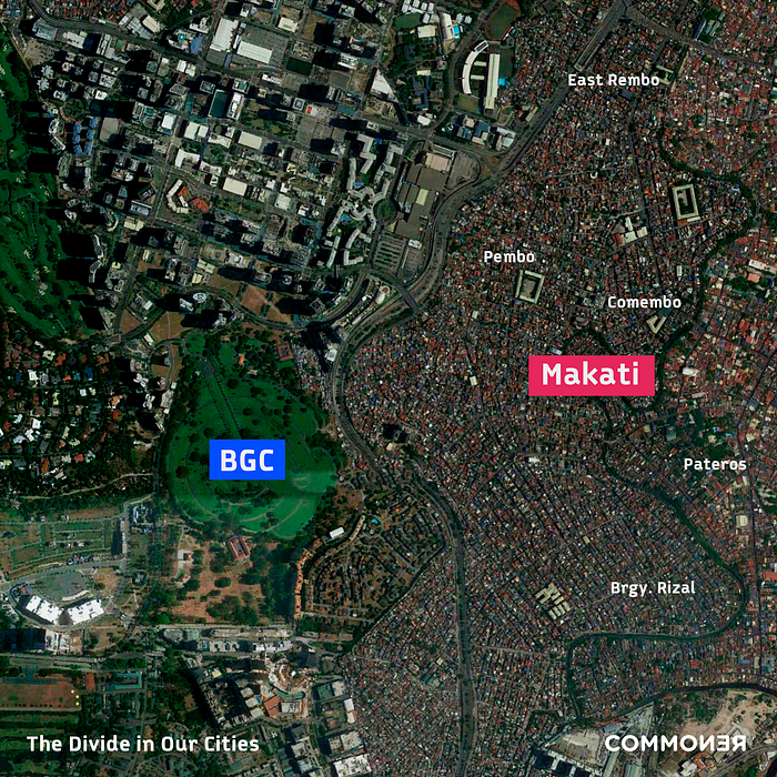
BGC and Makati

Located in Taguig, Bonifacio Global City (BGC) is the country’s commercial hub. You can find a budding business district surrounded by high-end malls, restaurants, and nightclubs. Just beside that is Makati’s residential areas: Brgy. Rizal, Comembo, Pembo, and East Rembo. Also known as the Embo Districts, these neighborhoods were originally constructed to provide housing for enlisted soldiers during the Second World War.
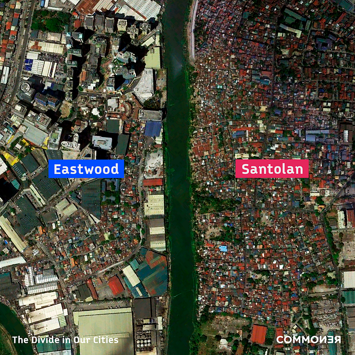
Eastwood and Santolan

In 1997, Megaworld Corporation launched Eastwood City as its first “live-work-play” community where you can find different establishments and amenities for work, shopping, playing, and living, as its name suggests. Eastwood City’s high rise buildings greatly contrast Santolan’s terracotta roofs in its residential areas. The former is located in Quezon City while the latter is a barangay in Pasig City.
Divide in our cities
The photos shown above shows something deeper: inequality. Tong told Commoner that in spite of the news of growth in our economy, poverty and social inequality remain widespread. If the economy has been thriving, why aren’t Filipinos able to feel it? There is an evident mismatch in the real living conditions of Filipinos against our economy that even cities look so divided from above.
Isola Tong is an architect and visual artist with biogeography, architecture, technobiopolitics, and queer futirity as the center of her works. Her research on a project, “Forest of Agencies“, inspired her to look into these aerial views.
If you want to learn more about Isola Tong’s Findings, read: The Divide in our Cities.


